Designed for the field
Work confidently throughout the day with an ergonomic, one-handed design, tactile backlit keypad, and bright display. IP66/68 protection keeps the CS50 ready for demanding field conditions.


.jpg?sc_lang=fr-ch)
Introduction d’une nouvelle dimension dans la capture de la réalité et redéfinition de la numérisation laser 3D.

The backbone of field performance

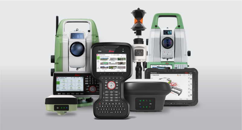
The Leica CS50 is the field controller built for surveying with Leica Captivate. Delivering reliable performance in tough field conditions, it handles large datasets, and demanding workflows with ease. By keeping instruments, software, and cloud connected, it helps surveyors stay productive, in control, and ready for the next job.

Work confidently throughout the day with an ergonomic, one-handed design, tactile backlit keypad, and bright display. IP66/68 protection keeps the CS50 ready for demanding field conditions.

Work smoothly with large datasets, CAD files, IFC models, and imagery. Fast, responsive performance keeps you moving between applications and job data.

Stay connected across networks and regions with physical SIM and eSIM support. The integrated DISTO™ lets you measure remote or inaccessible points without repositioning.

Do more without changing your setup. The integrated DISTO™ lets you capture remote or inaccessible points directly from the pole. The large display, tactile backlit keypad, and powerful hardware help you stay productive and in control in the field, and keep demanding survey data and applications running smoothly.

Keep working with a field controller designed for professional surveying. The IP66 and IP68 level protection, durability verified through MIL-STD-810H standard testing, a bright display, and a keypad designed for use with gloves and in wet conditions help keep the CS50 performing across challenging field conditions.
The Leica Geosystems-managed Linux operating system provides a stable and controlled environment with predictable software behaviour even when jobs get more complex. Fast system response when switching between apps, datasets, and tasks means less waiting between setup, measuring, and staking, so workflows don’t stall.

Keep data and teams moving wherever the job takes you. 5G connectivity, a physical SIM card, and eSIM support provide flexible connectivity across regions and deployments.
Together with Captivate and GeoCloud, the CS50 makes it easier to transfer project data between field and office and keep surveying workflows connected.
With Control in GeoCloud Fleet, compatible total stations and the CS50 can stay connected over the internet, extending communication beyond traditional Bluetooth limitations and giving surveyors more flexibility in how they work.
The Leica CS50 is part of the Captivate portfolio, connecting your software, total stations, and GNSS into a single integrated surveying workflow. From project preparation to final verification, every component works together to help you move efficiently between tasks and stay focused on the job.
As projects become more complex, the CS50 running Captivate provides the performance needed to work confidently with large datasets, imagery, and design models, while GeoCloud keeps field and office connected. Together, they help reduce interruptions, improve productivity and keep you ready for whatever the day brings.
In many cases, yes. The CS50 is running Captivate 2027 and newer versions only. However, the CS50 can connect to compatible Leica Geosystems instruments running Captivate v12 or newer, allowing you to continue using your existing equipment while upgrading to the latest field controller.
When connected to instruments running older software versions, some Captivate 2027 features may not be available, as they depend on capabilities provided by both the controller and the instrument.
The Leica CS50 supports connections to a wide range of Leica Geosystems surveying instruments.
Compatible total stations and multi-stations
Leica TS20
Leica TS60/TM60/MS60
Leica TS13 and TS16
Leica TS07 and TS10
Compatible GNSS smart antennas and GNSS receivers
Leica GS18
Leica GS16
Leica GS05
Leica GS10 and GS25
The CS50 supports two types of connectivity that help keep surveying workflows moving.
Instrument connectivity enables reliable communication with Leica total stations and GNSS receivers through Captivate, including long-range wireless connections to robotic total stations. Achievable operating distances depend on the instrument, connection method, site conditions and wireless interference. For remote operation beyond direct Bluetooth range, the CS50 also supports GeoCloud Fleet's Control, enabling a TS20 to be operated over the internet via the GeoCloud Fleet portal.
Network or data connectivity includes 4G/5G RedCap, WLAN, physical SIM and eSIM support, providing flexible options for connecting across networks, regions and project environments. These features help keep field crews connected to project data, cloud services and office teams throughout the surveying workflow.
The CS50 is designed to work as part of the Captivate ecosystem, making it easy to transfer survey data between field and office. Although transferring data via a micro SD card or USB-C stick is possible, the most efficient way to transfer data to and from the CS50 is GeoCloud. With GeoCloud, you can securely share data, collaborate across teams and keep projects moving efficiently between field and office. With Infinity, you can prepare projects in the office, process measurements and maintain a connected workflow from planning through to final deliverables.
Together, CS50, Captivate, Infinity, GeoCloud, and compatible total stations and GNSS smart antennas, create one connected surveying workflow. Surveyors can prepare projects in the office, measure and perform stakeouts in the field, then transfer data, and process, verify, share, and deliver results efficiently using a field controller designed to stay responsive throughout the working day.